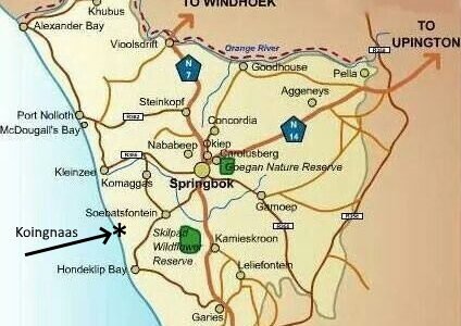
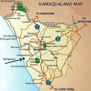
The small town of Koingnaas is situated on the Atlantic Ocean coast line in the Northern Cape province of South Africa, about 550km (370 miles) north from Cape Town.
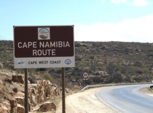
To drive from Cape Town to Koingnaas take the N7 national route that runs from Cape Town northwards through the West Coast and Namaqualand regions – this route goes up to the Namibian border at Vioolsdrif. (This is also called the Cape Namibia Route – or Cape West Coast route).
Drive north and stop at the small town of Garies (this is your last stop for gas and a café before you reach Koingnaas)
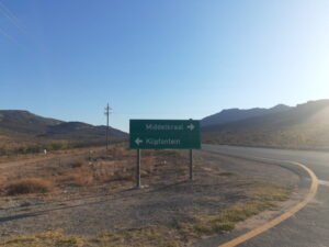
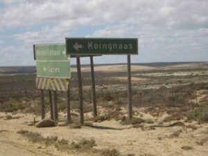
From Garies follow the N7 for about 10km and look for the sign-board “Klipfontein” on your left. This is where you want to turn LEFT to Koingnaas. This is a narrow but very drivable tar-road.
(NOTE: On your way to this “Klipfontein” turnoff – at about 6km from Garies, you will see a Koingnaas/Hondeklipbaai turn-off. This is a long dirt road and not recommended – unless you want to specifically do a scenic-route-drive)
From the Klipfontein – N7 – turn-off it is about a half an hour drive – about 20 km – to the small Klipfontein settlement/village.
Drive a few kilometres pass this village and the tar road suddenly ends.
From here it is a dirt road to Koingnaas – maybe about 70km – or at least an hour’s drive. You are now driving towards the coast line and will pass the runes of the old village of Wallekraal on the spoeg-rivier.
As you are getting closer to the coastline you will pass one of the entry gates to the Namaqua National Park.
Look out for the Koingnaas turn-off about 2 km’s from the tiny coastal town of Hondeklipbaai. Turn right toward Koingnaas and this 20km stretch dirt road will take you into the town of Koingnaas.
Stop at the Information Office for further directions.
30.196°S 17.287°E
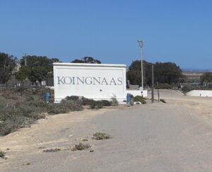
Welcome to Koingnaas