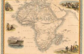
Below are a few Vintage Maps showing the position where the tiny town of Koingnaas would later be build. Studying the maps also give one and idea of how South Africa grow in 300+ years. Map number 5 is an map showing the different mining areas along the West Coast of Koingnaas. Most of these […]
Koingnaas
Namaqualand Village In South Africa
Koingnaas © 2022

